An unnamed, mostly hidden waterway runs through East Hampton Village.
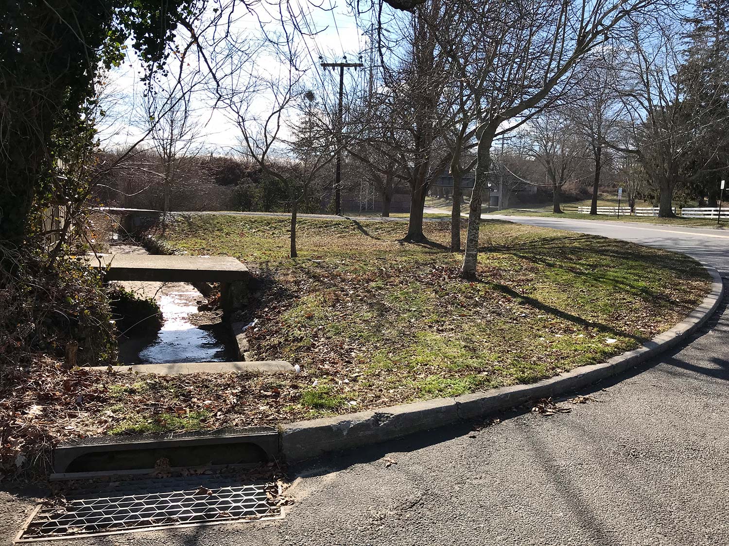
It originates from stormwaters near Round Swamp Farm, in the Freetown neighborhood, on the north end that are channeled through a peek-a-boo culvert that passes under the North Main Street train trestle and into the Methodist Lane bioswale. What isn’t absorbed by that sponge flows past Citarella through a pipe that drains under Fithian Lane into the East Hampton Village Nature Trail. Here, the waters are more familiar as they widen and mix into Hook Pond. But how many who stroll past them know their origin?
They end their journey by passing over a weir and through large pipes, laid under the dunes, into the ocean waters off Main Beach.
The stream carries nutrients from fertilizers, pesticides, road debris, trash, pets, wildlife, and anything else that falls in its watershed, which extends north of the train trestle up to Round Swamp Cemetery, west a few blocks from East Hampton High School, and east to the East Hampton Town Justice Court, according to a map provided by the Suffolk County Soil and Water Conservation District.
“It’s hundreds of acres,” Mara Dias, a senior manager for the Surfrider Foundation’s water quality initiative, said in a phone call. In 2021, the foundation helped build the Methodist Lane bioswale, which was designed by Tony Piazza of Piazza Horticultural in Southampton, as part of Surfrider’s Ocean Friendly Gardens Program.
The foundation tested the waters entering the bioswale twice in 2023, and both times they didn’t meet the water quality standards of the New York State Department of Health. Just downstream, at the Fithian Lane drain, the water met the state standards only 8 percent of the time.
The watershed is not under any special protection and those who live within it probably aren’t aware that if they’re at Main Beach, they’re likely swimming in whatever was on their lawns.
Dave Collins, the superintendent of public works for the village, drove up Oakview Highway last week and looked out the window of his truck. “You’re getting stormwater and whatever pollutants are with it into Hook Pond, from this far out,” he said. From Oakview Highway, the land slopes south toward the ocean, roughly two miles away. “The village’s policy is that we don’t spray pesticides or use herbicides.” Residents, however, are under no such strictures.
Groundwater flows toward the ocean as well, carrying whatever is added to it by septic systems. Mr. Collins said that between Oakview Highway and Cedar Street, natural springs rest just below the surface, and are often discovered when new foundations are dug. He remembered digging one such foundation before he worked for the village. “When we hit the spring, it was like opening a valve.” The Emergency Services Building, at 1 Cedar Street, is only two feet above groundwater. “We have huge sump pumps in the basement. When it rains a lot, the water table rises, and those pumps are running all the time.”
But back to the stormwater. “The bioswale has done a great job of soaking up a lot of that water,” said Ms. Dias. “It acts like a filter for things you can see, plastics and trash. We clean it a handful of times a year. The lower part of the plants in the bioswale are often covered with sediment and leaves.” Not seen are the nitrogen and phosphorus that are sucked up through the plant roots. Were they to make it to Hook Pond, they’d be fueling the algae blooms that can either be just a nuisance, or toxic.
“One garden is not going to be able to completely clean a watershed of that size,” said Ms. Dias. The overpopulation of deer and the ducks and rodents that are fed at the Nature Trail, or duck pond, also contribute to bacteria.
Mr. Collins drove up and down the village streets, Fithian, then Huntting Lane, and onto David’s Lane, surveying the flow of water, that day only a trickle. “The water is always moving,” he said, looking over a stone wall across from the duck pond. Pressed into a mound of silty sand, raccoon prints. “This is all road sand and silt that has been carried here by water.” Down at Dunemere Lane, the water widens, and the fairways of the Maidstone Golf Club dominate, surrounding the opening of Hook Pond.
In 2023, Surfrider tested the water at Dunemere too, where it met state standards 17 percent of the time. By the time it reaches the Hook Pond weir, well diluted, 89 percent of the time it meets the standards.
Just west of Dunemere is Town Pond, which is fed solely by a collection of stormwaters from a separate watershed that includes, in part, an area from Woods to Dayton Lanes. Under a green spit of land in front of the Hedges Inn a pipe runs from Town Pond into a narrow tributary that also feeds Hook Pond. “From a water-quality perspective, all the stuff that’s going into Town Pond also affects Hook,” said Mr. Collins.
In 1956, the village installed a weir to help control the water level of Hook Pond. At the time, The Star reported, “The new drain will make it possible to allow the state to stock Hook Pond with fish again, so that East Hampton people can enjoy quiet freshwater fishing there.”
A small waterfall is passing over the weir and through the pipes to the ocean as you read this, and it will be passing through in just a few months when people are swimming in that water. Beach passes for Main Beach sold out on Tuesday, in a matter of hours.
“We all have an opportunity to be part of the solution,” said Ms. Dias. “People can commit to not using pesticides and fertilizers and incorporate more native plants and buffers rather than having wall-to-wall sod carpets on our lawns. That would prevent yards from contributing to the runoff. As for septics, nothing here is sewered. What happens up on Three Mile Harbor Road ends up at Main Beach.”