Sanborn Fire Insurance maps are some of the best sources for historical property ownership and residency information from the mid-19th and 20th centuries. The standardized maps were created for 12,000 towns and cities across North America, beginning in 1867 and continuing through the 1970s.
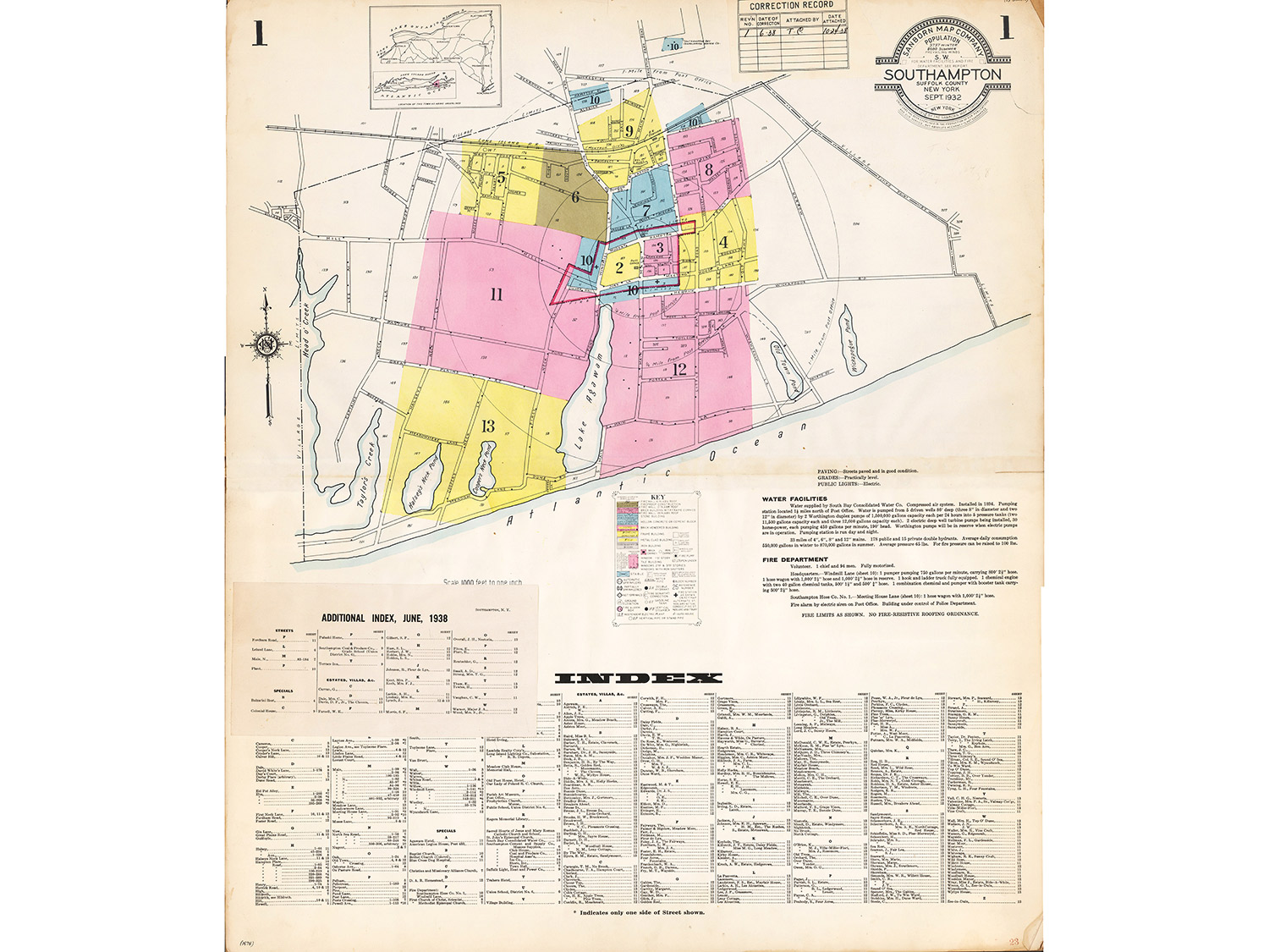
The Sanborn Map Company made this map of Southampton Village to record information, such as the size of buildings, relevant for issuing fire insurance.
Produced in 1932 and updated in 1938 by pasting changes over the original paper, the map in its entirety captures Southampton Town in 13 two-page spreads. The process of registering alterations by layering creates a map within a map, recording the changes within a town over time.
The seal in the upper-right corner of the first spread identifies the Sanborn Map Company as the maker and provides information pertaining to fire risk, like the prevailing wind direction. Each page details information that influenced insurance rates, such as property owners, roads, buildings, property lines, and bodies of water, with specific markings noted in the map key on the first page. The key explains the information communicated by color, letter, or mark, and includes information about building materials, fire hydrant locations, and building sprinkler systems.
This particular map is dominated by yellow buildings, signifying those that were built with a wood frame. An “S” or a “D” imprinted on the structures indicates a store or dwelling. Another informational section in the first pages organized the structures into categories of Streets, Specials, and Estates & Villas.
Many buildings that are still standing can be found in this book of maps, with details related to fire insurance. One is the original Rogers Memorial Library on Job’s Lane, with brick and brick veneer over frame, steam and furnace heating, and seven iron chimneys. It now houses the Peter Marino Art Foundation.
This Sanborn Fire Insurance map, and several others of nearby towns, were donated to the East Hampton Library by someone who received copies once used in the Osborne Trust Company offices here.
—
Moriah Moore is a librarian and archivist in the East Hampton Library’s Long Island Collection.